
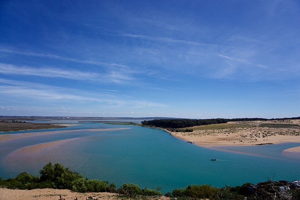

Three sediment cores from the lagoon beside Moulay Bousselham show why Morocco’s coastal carbon cannot be read from a single average. Researchers reconstructed an increase in organic-carbon accumulation in recent decades, but the pace differed between sampling sites. Their work measures carbon held in sediment and the rate at which it accumulated, not a ready-made quantity of emissions that Morocco can offset.
A carbon record beneath the meadow
The study by Nezha Mejjad and colleagues, published in Communications Earth & Environment on 16 December 2025, examined seagrass sediments in the Moulay Bousselham lagoon complex on Morocco’s Atlantic coast, north of Kenitra. One core came from Merja Kahla and two from Merja Zerga. All were collected on 12 July 2023. This is a reconstruction from dated samples, not a new survey of conditions in November 2026.
Seagrasses are flowering plants that grow in coastal waters. Their sediments can contain carbon from plant remains and material carried in from elsewhere. The term “blue carbon” describes carbon stored in coastal and marine ecosystems; in this study, the focus is organic carbon in the lagoon bed.
The researchers measured carbon content and dry sediment density, and used lead-210 dating, checked against caesium-137, to estimate when layers were deposited. Combining the amount of carbon with sediment accumulation produces a rate. A stock answers how much carbon lies within a specified depth; an accumulation rate answers how much was added per unit area and time. The two are not interchangeable.
More sediment can mean more accumulated carbon
For the top five centimetres, the paper’s Table 2 reports average estimated organic-carbon accumulation rates of 14.60, 53.08 and 22.14 grams per square metre per year for the Merja Kahla core and the two Merja Zerga cores respectively. These are site-specific, model-based estimates, not a lagoon-wide annual total.
The authors link the higher rates at the Merja Zerga sampling sites to faster sediment accumulation. Their explanation is important: sediment can deliver and preserve more carbon even where its organic-matter concentration is lower. Carbon concentration alone therefore cannot identify the place accumulating carbon fastest.
The study discusses changes associated with the Nador channel, which brings drainage from the Gharb plain into the lagoon system. It also identifies several possible sources of organic matter, including aquatic plants, algae and terrestrial inputs. Its isotope measurements help examine that mixture; they should not be read as proof that every gram of buried carbon came from seagrass.
A map and a core answer different questions
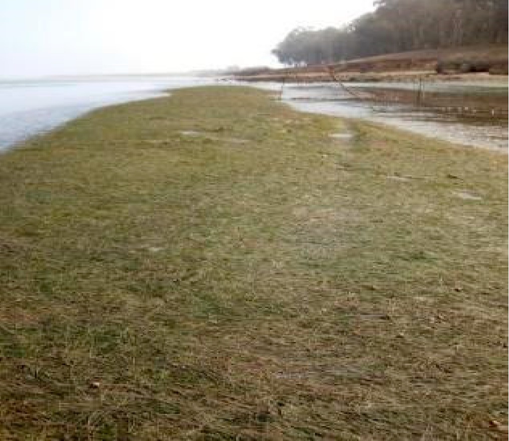
A core samples one location. Estimating a whole lagoon’s carbon requires knowing which habitats occupy which areas and how representative those samples are. Benmokhtar and colleagues’ 2021 mapping study separated dwarf eelgrass, mixed eelgrass-algae beds and other surfaces using satellite imagery and field observations. Their 2023 study of changes between 2010 and 2020 also shows why tide levels and seasonal algae matter when comparing habitat maps.
The carbon paper’s one-metre stock estimates involve a further step. The actual cores were shorter than one metre, so the authors extended carbon and density profiles using global-average gradients. Those estimates are extrapolations, not measurements from a metre of sediment at every site. Multiplying a selected core’s value by the whole lagoon area would add an assumption that these samples do not establish.
The published text also contains numerical inconsistencies, including four one-metre stock values listed for three cores, and a mismatch in two core-length labels between methods and results. Those unresolved details are why no one-metre stock total is reproduced here. An author correction published on 13 March 2026 fixed figure-axis labels; its stated scope did not address those numerical issues.
Stored carbon is not yet a project benefit
A 2022 critical review by Sophia C. Johannessen explains the wider scientific difficulty: carbon near the sediment surface may still be mixed, decomposed or resuspended. Estimating durable net sequestration requires attention to burial depth, carbon sources and what would happen without the meadow. This is a methodological caution, not an independent reanalysis disproving the Moroccan study.
Likewise, the IUCN’s 2021 blue-carbon project manual distinguishes a carbon stock from a project benefit measured against a baseline. The lagoon paper does not certify a carbon-credit project, establish a credit price or calculate revenue. Nor does greater carbon accumulation alone prove improved ecological health.
That last distinction matters in a wetland whose sediments also support a food web. Carbon is one function of the lagoon, not a substitute for habitat condition. The history of marshland change in the neighbouring Gharb plain is a separate land-use record, not a carbon loss estimate that can be added to these cores.
The value of the sediment study is a local carbon history and a clearer research agenda: measure variation, improve habitat coverage and test how much carbon remains durably buried. It brings Morocco’s coastal sediments into the evidence base without turning three sampling points into a national climate balance sheet.
Sources and method: Source-based science explainer.The original study, its correction, mapping research and relevant methodological material were inspected. No site visit, new sampling, independent laboratory analysis or carbon-credit audit was conducted. Published estimates retain their dates, units and geographical limits; unresolved numerical inconsistencies are disclosed above.
Lead archive photograph: Merja Zerga, Moulay Bousselham, 16 April 2016. Younes MAHRACH / Wikimedia Commons, CC BY-SA 4.0. Full-frame reproduction at reduced resolution; no generative changes. The theme may crop the header. Not evidence of current habitat condition or a photograph of a coring site.
