
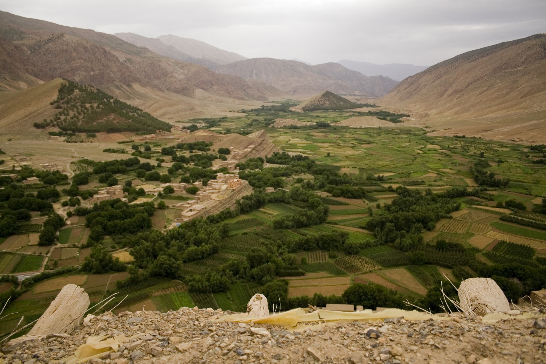

M’Goun’s UNESCO Global Geopark label connects an internationally important geological landscape in Morocco’s central High Atlas with a practical obligation: to manage it for conservation, education and the people who live there. The designation is neither a promise that tourism income will rise nor a substitute for the laws and daily work that protect individual sites.
That distinction matters in a territory where mountain villages, cultivated valleys and geological landmarks share the same landscape. UNESCO’s M’Goun profile places the geopark east of Marrakesh. Its local organisation lists sites ranging from the Ouzoud waterfalls and Imi n’Ifri natural bridge to rock engravings, dinosaur footprints and cliff granaries. The rocks are the starting point, but the institution is not meant to manage rocks in isolation.
A designation with an operating model
UNESCO’s rules, updated in August 2026, require geological heritage of international significance, a legally recognised management body, visibility and participation in the Global Geoparks Network. A management plan must cover conservation alongside governance, finance, infrastructure, partnerships and local social and economic needs.
The approach differs from simply placing a celebrated monument on a map. UNESCO distinguishes Global Geoparks from World Heritage sites and biosphere reserves. World Heritage recognition concerns natural or cultural sites of outstanding universal value; geoparks connect internationally significant geological heritage with education and local development. One designation should not be casually substituted for another.
Nor does Global Geopark status by itself prohibit every economic activity within the boundary. UNESCO says activities may continue where they comply with the relevant legislation. Its conservation rules nevertheless require appropriate protection for the defining geological sites and site-specific management measures. International recognition and enforceable protection therefore need to be read together, rather than treated as the same thing.
Who does the work in M’Goun?
The geopark’s own description of its organisation identifies an orientation and monitoring council, the Association du Géoparc du M’Goun and a permanent management structure. It describes the project as supported by the Béni Mellal-Khénifra regional council, with local authorities, public services, civil society, businesses and scientists involved.
Its 2020-2021 activity report gives a more concrete picture of that coordination. The association reported creating a technical committee and local relay organisations, working with tourism providers and cooperatives, and organising educational and promotional activities. It also identified the difficulty of maintaining a continuous local presence across a large territory.
Those are the association’s reported activities for that period, not an independently audited account of present-day performance. They show the range of tasks the geopark model involves. They do not establish how much extra income reached households, whether every site received adequate maintenance or how conditions have changed since then.

Tourism and protection did not begin together
A study published in August 2026 by geographer Jonathan Bussard helps explain why a label cannot stand in for an outcome. It compares heritage recognition and tourism development in Switzerland, Iceland and Morocco, using literature, field visits and stakeholder interviews. The Moroccan work included visits in 2021 and 2022 and nine interviews conducted in French.
Bussard traces mountain hiking tourism to before the geopark’s creation, while the geological conservation initiative arose from concern about vulnerable dinosaur footprints. He records entry into the Global Geoparks Network in 2014 and UNESCO Global Geopark designation in 2015. These are different institutional milestones, not two competing dates for one event.
The distinction also keeps the geopark separate from the scientific interpretation of any particular fossil. Reading the dinosaur tracks requires evidence about the surfaces and traces themselves. Managing the wider territory requires organisations, interpretation, local participation and conservation work. Neither task replaces the other.
In Bussard’s interviews, tourism professionals saw potential in greater visibility, better visitor information, training and infrastructure; some also stressed site protection and shortcomings in communication. These are the views of a small professional sample gathered several years before publication, not a representative survey of residents in 2026 or proof of a measured tourism effect.
The label has to be renewed
UNESCO’s revalidation process, updated in October 2026, examines geoparks every four years, using a progress report and a field mission by two evaluators. A green card continues the designation for four years. A yellow card gives management two years to address shortcomings; failure to meet the criteria after that period can lead to loss of status. These are the programme’s general rules, not a claim that M’Goun currently holds a warning.
For readers, the useful question is what the designation enables people to do: explain a landscape, protect its evidence and sustain activities that belong there. Morocco’s collective granaries offer another example of heritage whose meaning depends on organisation as well as physical structures. In M’Goun, the UNESCO name makes a management commitment visible. Judging its results still requires evidence from the ground.
Sources and method: This explanation uses UNESCO’s programme rules and site profile, the geopark’s own organisational pages and historical activity report, and Bussard’s 2026 study. It is not a field visit, a legal audit of each geosite or an independent measurement of household income, conservation outcomes or current visitor facilities. No interviews were conducted for this article.
Lead photograph: “View over Aït Bouguemez”, photographed on 19 July 2009 from near Tabant’s communal granary. © İhsan Deniz Kılıçoğlu, Wikimedia Commons, CC BY-SA 3.0. Resized and recompressed; this image version remains under the same license. Archive landscape context, not a November 2026 condition report.
